Gaoua
Gaoua is a market town in southern Burkina Faso known for its superstitious values and customs. The population, rested at 45,284. (2019 census) Located in the red earth, green hills, and fast flowing streams of southwestern Burkina Faso, Gaoua is the capital of Poni Province and forms a sort of capital for the sacred rites and bush lore of the Lobi peoples. According to local myth, Gaoua was founded when the Lobi migrated across from northern Ghana where they found the Gan people peoples occupying the territory. As a result, they named the trek across to Gaoua Gan-houo meaning "route of the Gan people".
Attractions in the town include a sacred grove of trees, the Poni Museum (Musée des Civilisations des Peuples du Sud-Ouest or Musée du Poni) and caves. There is also a mosque on elevated ground near the centre. The Gaoua Catholic parish Church of the Sacred Heart will be the cathedral for the newly erected Catholic Diocese of Gaoua.
Though their ancient home was considered to be Takyiman in Ghana, the Lobi migrated across the Mouhoun River as a result of the Dagomba Wars in the 1770s. Thirty years later, the Lobi displaced the Gan at Gaoua. The French occupied southwest Burkina Faso in 1879, based on the region's reputation for gold, dating back to the era of Mossi and Dyula gold traders. Although primarily farmers, the Lobi did partake of gold panning around Gaoua, besides Gaoua being on a trade route to the Poura gold mines further north.
Map - Gaoua
Map
Country - Burkina_Faso
 |
 |
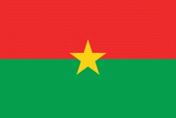
| Flag of Burkina Faso | |
The largest ethnic group in Burkina Faso is the Mossi people, who settled the area in the 11th and 13th centuries. They established powerful kingdoms such as the Ouagadougou, Tenkodogo, and Yatenga. In 1896, it was colonized by the French as part of French West Africa; in 1958, Upper Volta became a self-governing colony within the French Community. In 1960, it gained full independence with Maurice Yaméogo as president. Throughout the decades post independence, the country was subject to instability, droughts, famines and corruption. Various coups have also taken place in the country, in 1966, 1980, 1982, 1983, 1987, and twice in 2022, in January and in September, as well as an attempt in 1989 and another in 2015.
Currency / Language
| ISO | Currency | Symbol | Significant figures |
|---|---|---|---|
| XOF | West African CFA franc | Fr | 0 |
| ISO | Language |
|---|---|
| FR | French language |


